


universal plotting sheets for celestial navigation
also known as VP-OS sheets
pdf - A4 and A3 (new)
a tool to draw the graphic of celestial navigation like on a nautical chart: a custom-made chart for any latitude printable in A4 or A3 size

minutes of latitude, nautical miles and " intercept " (Ho-Hc) :

How to determine the longitude scale at your latitude (30° North or South in this example) in 4 steps:
step 1
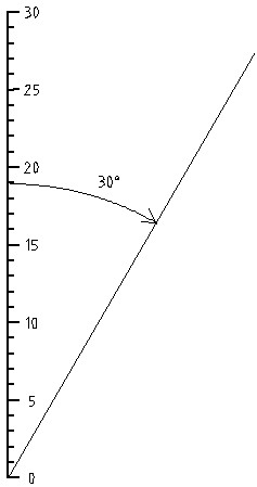
step 2
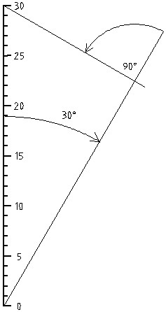
step 3
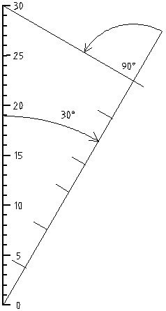
step 4
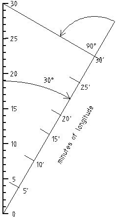
| Download " Plotting Sheet " |
© nauticalalmanac 2026 - all rights reserved
A4-3350-2020-01-31