


The Nautical Almanac - Sun and stars
by Capt. Roberto Iori
astronomical data for celestial navigation - years 2026 & 2027 (PDF or excel spreadsheet)
The "PDF version" contains: daily pages of the nautical almanac, increments and correction tables for Sun and Aries, corrections to apply to the observed altitude of Sun and fixed star, conversion of arc to time, speed-time-distance table and mounthly pages with 97 additional nautical stars.
The excel version generates the essential data needed for the pratice of celestial navigation - This free software creates daily pages (a printable sheet - A4). All these astronomical data and information allow mariners to calculate the ship position with the traditional method of the celestial navigation (using a sextant).
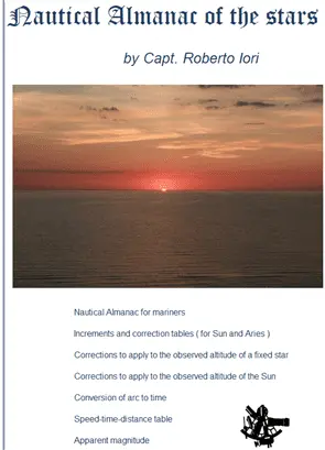
description of the nautical almanac ( astronomical almanac for mariners )- "excel" version
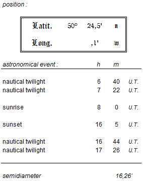
Entering latitude and longitude of the estimated position excel automatically calculates the times of the astronomical events in U.T. (Greenwich Mean Time) : twilight, sunrise and sunset.
view of the The Nautical Almanac of the stars in excel version
The excel spreadsheet (software) shows :
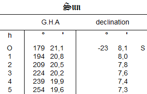
Sun : Greenwich hour angle (G.H.A.) and declination tabulated at hourly intervals including increments, semi-diameter and meridian passage at Greenwich :

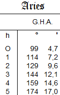
Aries : hour tables ( Greenwich hour angle - sideral time ) :
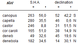
Stars : position tables ( sideral hour angle - S.H.A. and declination ) - 64 stars are tabulated (Polaris included) :
On the nautical almanac the astronomical events are shown according to the geographic coordinates : nautical twilights, sunrise and sunset . Times are expressed in Universal Time (U.T.) - Latitude 50° 24,5' North and longitude 0°00,1 West are the geographic coordinates (approx.) of the lightvessel "Greenwich" at the southern entrance to The Channel ( in the middle of the separation zone ). New coordinates are required for the real estimated position (or country, town etc.). :
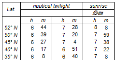
In the sheet " standard latitudes " events at fixed latitudes/Greenwich longitude are shown like a traditional nautical almanac :
It can happen with excel!
A file downloaded from the Internet is usually opened in "Protected View", because this file can contain viruses or malware.
This means that if you want to modify values contained in cells you cannot do so.
You can enable editing in this way: in the Ribbon, click File > Info > Enable Editing.
accuracy
Hour angles and declinations are calculated with a precision equal to that given in the traditional Nautical Almanac. VSOP87 Theory has been incorporated in the program and allows the calculation of the position of the sun with an error not exceeding 2". Results has been rounded to the nearest value (0,1 arcminute).
disclaimer and use
The excel spreadsheet is a freeware software and the pdf version is a free book. The redistribution is forbidden and the download is possible from this website only. This Almanac does not intend to substitute the traditional Nautical Almanac. The software has the following characteristic: " as is " without any express or implied warranties of any kind. The user assumes full responsibility for the use of the software.
We would be happy to receive comments, suggestions and ratings in the Guestbook!
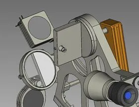 |
| A video of a nautical sextant by Capt. Roberto Iori |
© nauticalalmanac 2026 - all rights reserved